You can find dynamic WebGIS maps on our ArcGIS Online gallery:
http://sig-peu-ufrj.maps.arcgis.com/home/index.html
You can find more maps inside Final Report PDF document (Portuguese and French versions):
Final Report
Get here the poster with mobility survey georeferenced data map (PDF):
Poster_mapas
Discover bellow some maps of Cidade Universitária-UFRJ campus area:
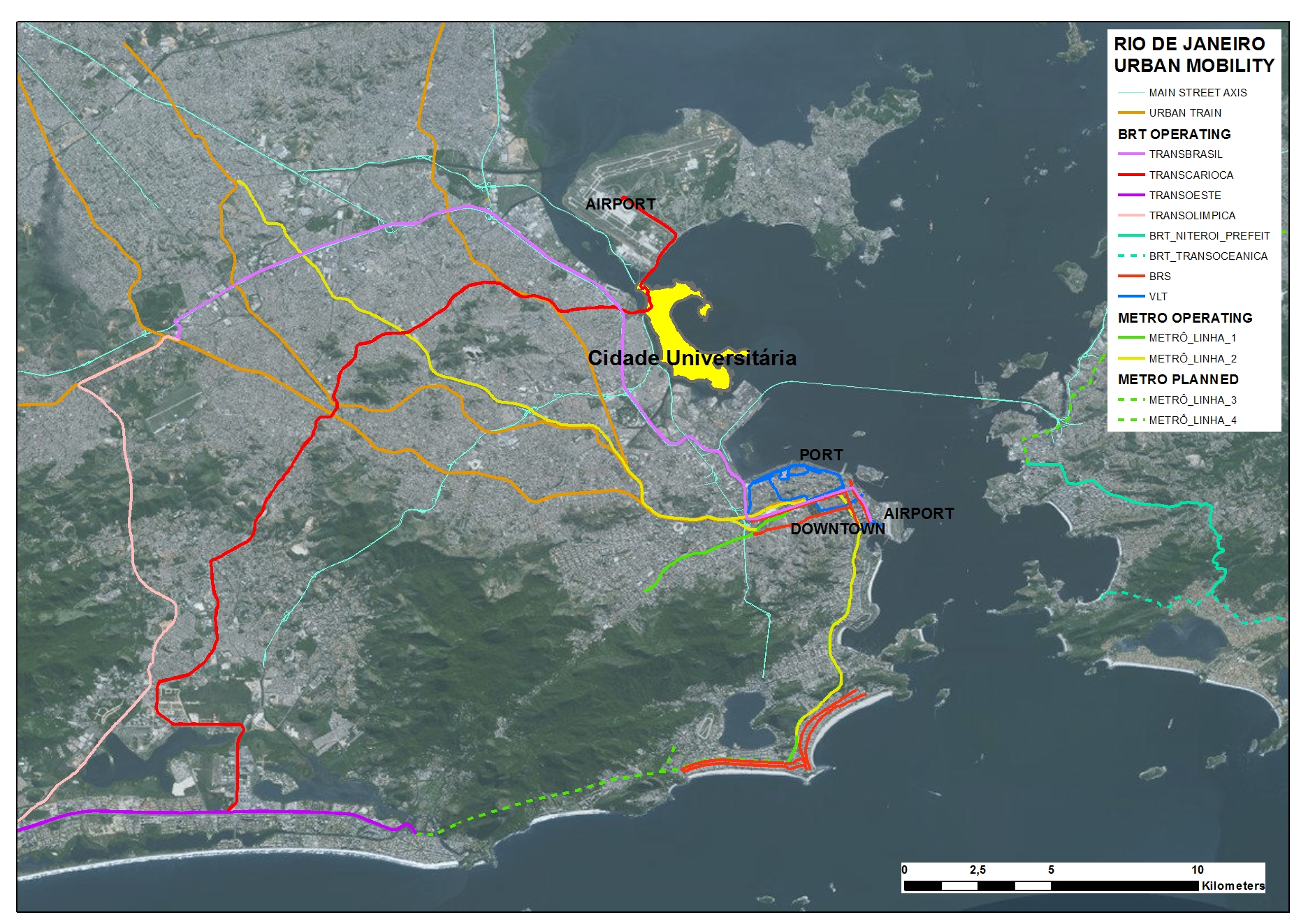
Public Transportation systems near Cidade Universitária-UFRJ campus area
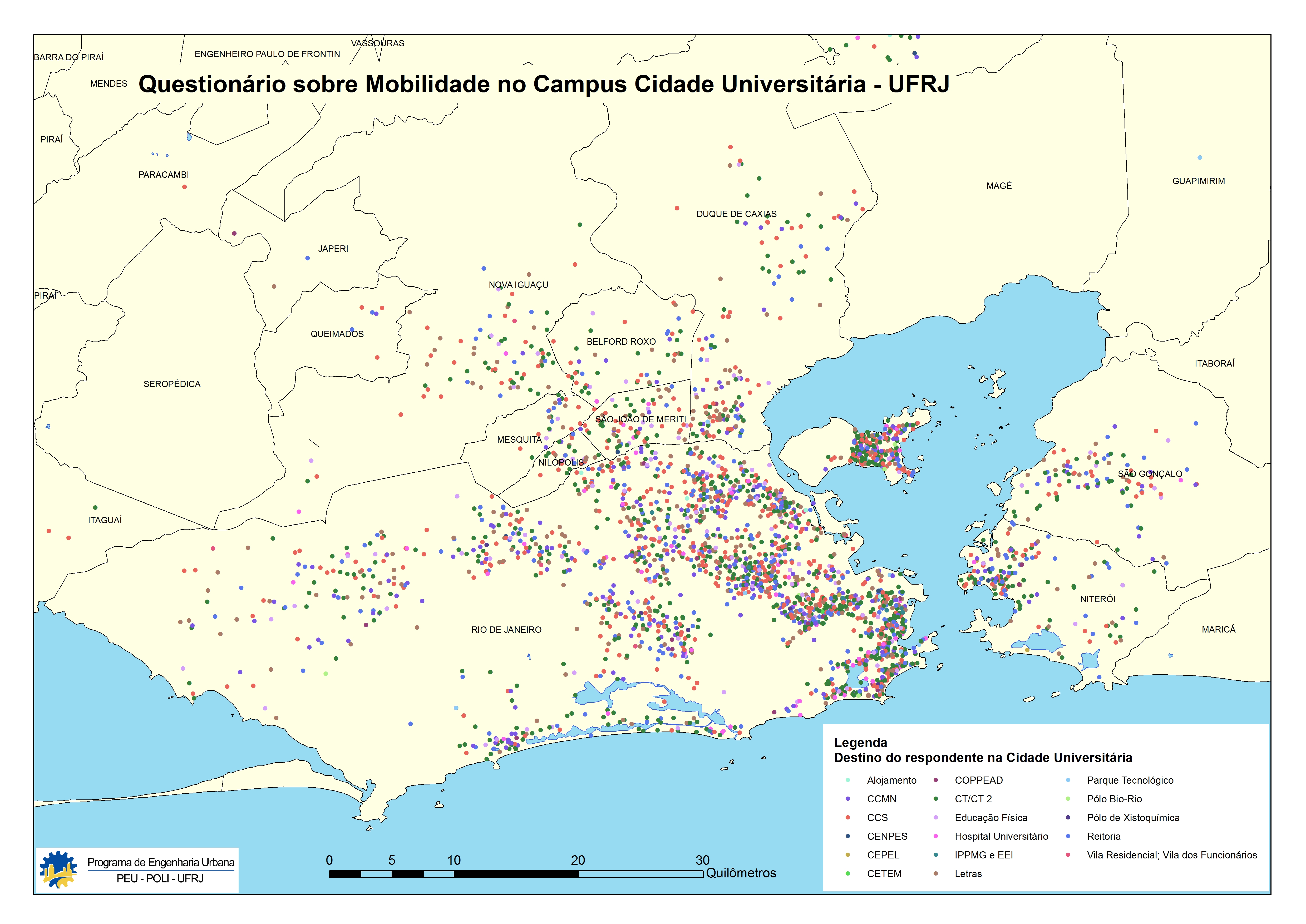
UFRJ users destination (survey data) – Point in the map is user residence and color represents the destination inside campus
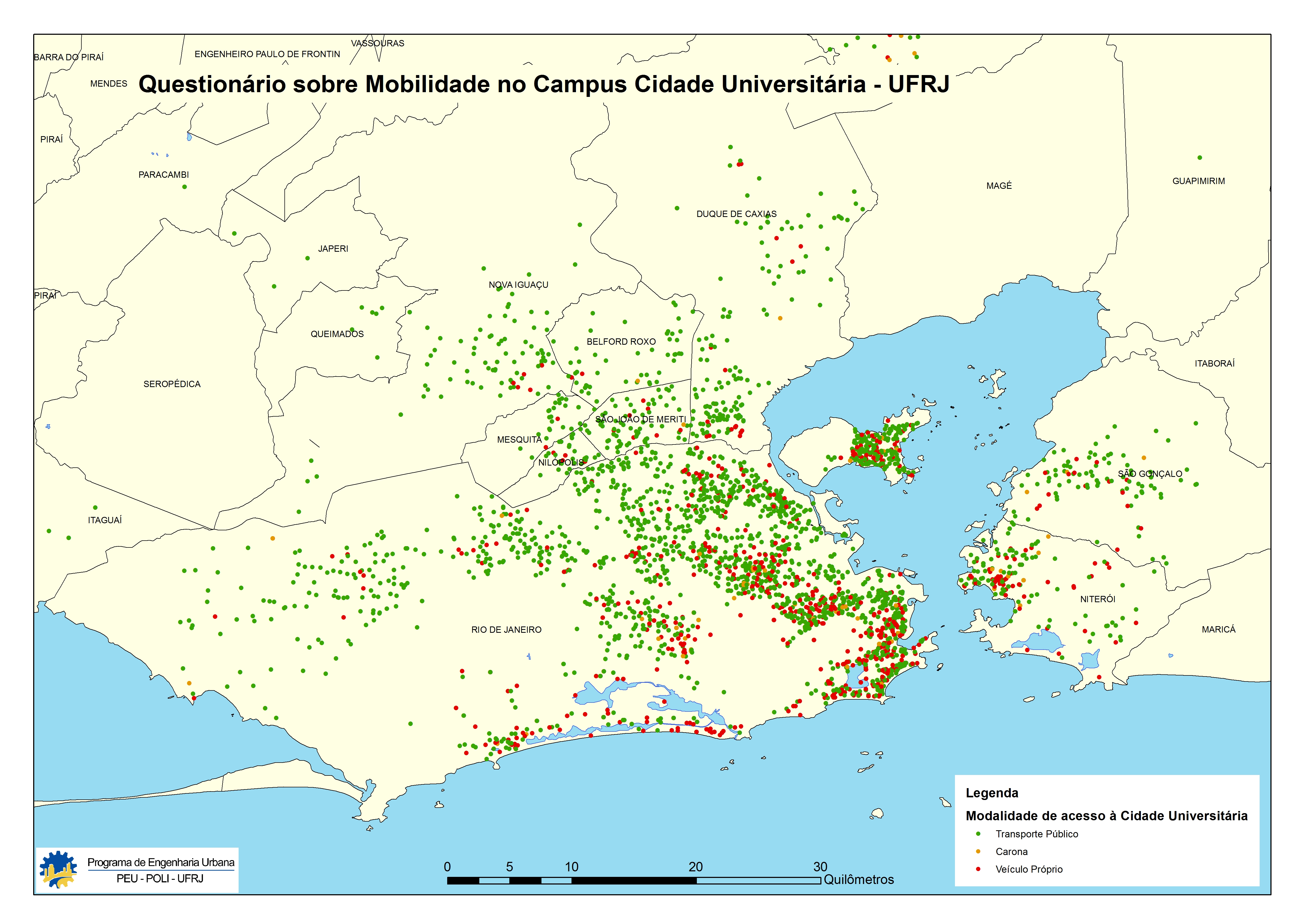
UFRJ users transportation (survey data) – Point in the map is user residence and color represents the transportation that users go to campus;
green: public transportation, yellow: shared vehicle, red: own vehicle